Vallée de Cœur from Le Cochenet – hiking trail

Hard
6h
17km
Loop
+800m
-800m
Vallée de Cœur from Le Cochenet – hiking trail image1Vallée de Cœur from Le Cochenet – hiking trail image2Vallée de Cœur from Le Cochenet – hiking trail image3Vallée de Cœur from Le Cochenet – hiking trail image4Vallée de Cœur from Le Cochenet – hiking trail image5Vallée de Cœur from Le Cochenet – hiking trail image6Vallée de Cœur from Le Cochenet – hiking trail image7Vallée de Cœur from Le Cochenet – hiking trail image8Vallée de Cœur from Le Cochenet – hiking trail image9Vallée de Cœur from Le Cochenet – hiking trail image10Vallée de Cœur from Le Cochenet – hiking trail image11Vallée de Cœur from Le Cochenet – hiking trail image12Vallée de Cœur from Le Cochenet – hiking trail image13Vallée de Cœur from Le Cochenet – hiking trail image14Vallée de Cœur from Le Cochenet – hiking trail image15Vallée de Cœur from Le Cochenet – hiking trail image16
1 / 16

Description

Discover the Vallée de Cœur trail on this loop hike: a hike for experienced hikers offering breathtaking views of the mountains.

Discover the Coeur Valley hiking trail starting from Le Cochenet, ideal for experienced hikers (red level).

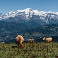
The route begins in the forest, where the trail climbs gently before opening up onto the alpine pastures of the Coeur Valley.

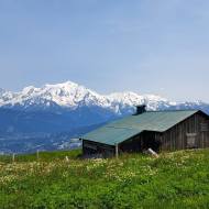
The trail then takes you to the ridge, near the Petit Pâtre hut, where you can enjoy a spectacular view of the Aravis range and Mont Blanc from the picnic tables provided.

You’ll then head toward Tête Noire before descending back into the forest to reach L’Abérieux and its farm, a point of interest in the village of Cordon. You’ll finish your hike in the shade of the trees on a trail leading to the Cochenet parking lot.

Marking

Departmental signage on a beige metal sign with green lettering

Map references

IGN Map 3430ET - LA CLUSAZ LE GRAND-BORNAND
"Les Belvédères du Mont-Blanc" map on sale for €7 at the tourist office
Snowshoe and summer trail map from Cordon Tourisme
Amenities

Guided steps

1/ Park at the Cochenet parking lot,
2/ Follow signs for "Abérieux" / "Pont de la Flée"
3/ When you reach the Pont de la Flée, take the steep path toward the "Pierre Fendue"
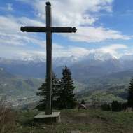
4/ From the “Pierre Fendue,” head toward the “Chalets de Coeur” and climb up to the Col de Niard: 1,801 meters above sea level.
6/ To descend, head toward the “Cabane du Petit Pâtre” and the “Chalets des Bénés”
7/ Then follow signs for “Tête Noire,” “Le Perray,” and “Les Molliards,”
8/ Follow signs for “L’Abérieux” to return to the “Cochenet” parking lot.

Along the way

Address
Parking du Cochenet, Le Cochenet 710 Rte de la Plagne, 74700, Cordon
Opening
All year round daily. The dates are approximate and may vary depending on snow conditions; please contact Cordon Tourisme for the latest information. Subject to favorable snow and weather conditions.

Was this content helpful to you?

Address
Parking du Cochenet, Le Cochenet 710 Rte de la Plagne, 74700, Cordon
Opening
All year round daily. The dates are approximate and may vary depending on snow conditions; please contact Cordon Tourisme for the latest information. Subject to favorable snow and weather conditions.