
Pont des Nants Loop - Mountain Bike Route No. 28
Hard
1h30min
14km
Loop
+687m
--685m


1 / 5
Description
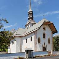
The Pont des Nants Loop, mountain bike route No. 28, is a varied trail that combines forest trails and paved roads. It’s the perfect way to explore the village of Cordon and its hillsides!
This loop can be ridden on mountain bikes, e-mountain bikes, and e-bikes.
Mountain bike trail No. 28, the Pont des Nants Loop, is ideal for exploring the village of Cordon: Starting from the village center, you’ll head up one of the hillsides before descending back down to the lower part of the village and exploring the Jorasse Forest. In the Jorasse Forest, you’ll enjoy nature, its bounty, and its picturesque spots, including our famous Pont des Nants.
Accessible to mountain bikers, it combines moderate technical difficulty with the joy of riding in the mountains.
For the more athletic, the route can be extended from Les Plaines all the way to the Avenaz alpine pasture.
Please note: depending on the type of bike you have, the duration of the loop will vary:
- For a mountain bike, the loop will take 1 hour and 30 minutes
- On an e-MTB (electric mountain bike), the loop takes 1 hour
- On an e-bike (electric hybrid bike), the loop takes 1 hour and 15 minutes
Difficult sections
There are two tricky sections on this route:
- As you head down the Chemin du Chêne, the trail can be a bit steep—don’t hesitate to get off your bike.
- When heading down the Chemin des Plaines toward the Pont des Nants, the trail can be a bit steep—don’t hesitate to get off your bike.
Marking
The trail is marked with beige signs featuring orange triangles: the color inside the triangles indicates the difficulty level of the trail.
Map references
Map of Mountain Bike Routes in the Mont Blanc Region, available for purchase at the tourist office
Cordon Tourisme Summer Trail Map